Mumbai 3.0 Project: 323 Sq Km New City Planned Across 124 Villages in Raigad
Maharashtra advances its Mumbai 3.0 plan as MMRDA appoints Surbana Jurong to prepare a master plan for a 323.44 sq km new city across 124 Raigad villages.

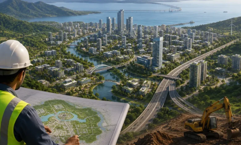
- Mumbai 3.0 Project will cover 124 villages across Uran, Panvel and Pen talukas.
- Surbana Jurong has been appointed to prepare the vision document and master plan.
- Atal Setu and Navi Mumbai International Airport are expected to boost connectivity.
Maharashtra has taken a major step towards developing Mumbai 3.0, a proposed new urban centre spread across 323.44 sq km in Raigad district. The Mumbai Metropolitan Region Development Authority (MMRDA) has appointed Singapore-based urban planning firm Surbana Jurong Infrastructure Pte Ltd to prepare the project’s vision document, master plan and overall planning framework.
The development, officially known as the Karnala-Sai-Chirner (KSC) New Town, is planned across 124 villages in Uran, Panvel and Pen talukas.
The project is being planned as a new growth centre between Mumbai and Navi Mumbai, with the aim of creating additional residential, commercial and employment hubs outside the existing metropolitan centres. Its location also gives it strategic importance, as the proposed city will benefit from its proximity to the Atal Setu (Mumbai Trans Harbour Link) and the Navi Mumbai International Airport.
The combination of these connectivity links could significantly influence future real estate and economic development in the region.
The proposed KSC New Town will bring 124 villages under a coordinated urban development framework. Instead of allowing the area to grow in an unplanned manner, the proposed master plan is expected to determine how residential neighbourhoods, commercial districts, employment centres, logistics facilities and public infrastructure will be developed.
The broader vision also includes opportunities for sectors such as education, healthcare, technology, innovation and commerce. This could create a mix of housing and employment rather than turning the region into a purely residential township.
The appointment of Surbana Jurong marks the transition of Mumbai 3.0 from a broad government vision to a more detailed planning stage. The firm has been tasked with preparing the vision document, master plan and comprehensive planning framework for the proposed new town.
The planning exercise will be important in determining the future structure of the 323.44 sq km area, including land use, infrastructure requirements, transportation networks, economic zones and other urban facilities.
Connectivity is expected to be one of the biggest advantages of the proposed development. Mumbai 3.0 is located within the broader influence zone of the Atal Setu, which has improved the road connection between Mumbai and the Navi Mumbai region.
The Navi Mumbai International Airport is another major infrastructure project expected to influence development around the region. Along with road, rail, metro and logistics networks, these projects could make the proposed new city more accessible to businesses, residents and investors.
The improved connectivity may also encourage the development of logistics, warehousing, commercial activity and supporting industries around the new urban centre.
The land acquisition process for Mumbai 3.0 began in April 2026, according to the project details. The authorities have proposed different compensation mechanisms for affected landowners.
These include monetary compensation, Floor Space Index (FSI), Transferable Development Rights (TDR) and a land pooling model. Under land pooling, eligible landowners contribute their land to the development process and can receive a share of the developed land in return.
The compensation structure is expected to be an important part of the project’s implementation, given the large geographical area and number of villages involved.
The proposed city is being positioned as more than another residential township. Maharashtra’s larger objective is to create new employment and economic centres within the Mumbai Metropolitan Region, while reducing the pressure on Mumbai and Navi Mumbai.
Mumbai has long faced challenges related to population density, limited land availability, traffic congestion and pressure on existing infrastructure. Developing another well-planned urban centre could help distribute future population growth and economic activity across a wider region.
The strategic location between Mumbai, Navi Mumbai and the airport corridor could further increase the area’s importance as new infrastructure becomes operational.
The immediate focus will be on the vision document and master plan being prepared by Surbana Jurong. These documents are expected to provide the framework for how Mumbai 3.0 will be developed, including land use, infrastructure, transportation, economic activity and urban services.
As planning progresses, further details are likely to emerge on development zones, infrastructure projects, land pooling, compensation and implementation timelines. For residents and landowners across the 124 villages, these decisions will be particularly significant because the master plan will shape the area’s long-term development.
Also Read: Madhuri Dixit Sells Mumbai Office for Rs 4.85 Crore
Also Read: Mumbai Luxury Real Estate Records ₹18,512 Crore Sales in H1 2026